2014
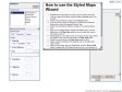
Map Style Editor | MapStylr
MapStylr is a free online tool that helps you create, store and publish unique google map styles.
MapTiler - fast maps for the web and mobile. Prepare map tiles for Google Maps, Google Earth KML SuperOverlay
by 1 otherDrop images of maps into MapTiler and with a couple of clicks the software prepares HTML files with viewers based on Google Maps API, Leaflet and OpenLayers. Enjoy the maps on your mobile phone or tablet even while offline.
2013
Create beautiful dynamic data driven maps | CartoDB
by 1 other (via)Create map visualizations with ease.
Upload and visualize your data within minutes and share or
embed them.
TileMill | Fast and beautiful maps
by 3 othersWhether you're a journalist, web designer, researcher, or seasoned cartographer, TileMill is the design studio you need to create stunning interactive maps.
2011

CloudMade Maps
Custom maps with openstreetmap
2010

adresses map / trouver les coordonnées
by 1 otherEn utilisant l'outil ci-dessous, copiez n'importe quel genre de liste d'adresses à partir d'Excel et elles seront géocodées, c'est à dire localisées en latitude et longitude. Les données peuvent alors être cartographiées dans votre navigateur, imprimées, chargées dans Google Earth, enregistrées sur une page web, ou transférées de nouveau dans votre feuille de calcul. C'est rapide, facile et gratuit !
1
(8 marks)