June 2007
Chez Xavier - Géolocalisez vos photos en PHP
by 2 othersAvec l'avènement de services de cartographie avancés sur le Web, comme Google Maps ou Yahoo! Maps, la localisation géographique de données peut désormais aisément être mise en œuvre par les concepteurs Web. Cet article présente un processus de géolocalisation de photographies, depuis la collecte des données jusqu'à leur affichage sur une carte Google Maps, en passant par la synchronisation entre le GPS et l'appareil photo et le marquage EXIF [1] des photos.
November 2006
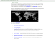
About Geo-Names
(via)The geonames.org geographical database is available for download free of charge under a creative commons attribution license. It contains over eight million geographical names and consists of 6.2 million unique features whereof 2.2 million populated places and 1.8 million alternate names. All features are categorized into one out of nine feature classes and further subcategorized into one out of 645 feature codes.
The data is accessible free of charge through a number of webservices and a daily database export.
Geonames is integrating geographical data such as names, altitude, population and others from various sources. All lat/long coordinates are in WGS84 (World Geodetic System 1984). Users may manually edit, correct and add new names using a user friendly wiki interface.
October 2006
GSmapSearchControl Solution
by 2 others (via)The GSmapSearchControl Solution is a simple to use application of the Google AJAX Search API that is designed to let you easily add a searchable map to your pages, sites, and blogs.
1
(3 marks)