2011

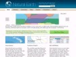
Natural Earth
Natural Earth is a public domain map dataset available at 1:10m, 1:50m, and 1:110 million scales. Featuring tightly integrated vector and raster data, with Natural Earth you can make a variety of visually pleasing, well-crafted maps with cartography or GIS software.
2010

OpenGeo : Home
The OpenGeo Suite is the fully-integrated open source geospatial platform for serving maps and data through web applications, mobile devices, and desktop clients.
2009
2008


2007
geotagged - Nicolas Hoizey's Tagged Photos - Google Maps
Mes dernières photos sur Google Maps en 10 secondes grâces aux flux GeoRSS de Flickr !
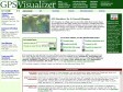
GPS Visualizer
GPS Visualizer is a free, easy-to-use online utility that creates maps and profiles from GPS data (tracks and waypoints), street addresses, or simple coordinates.
gpicsync - Google Code
GPicSync automatically inserts location in your photos metadata so they can also be used with any 'geocode aware' application like Picasa/Google Earth, Flickr, loc.alize.us, etc.
geotagged - Nicolas Hoizey's Tagged Photos - Google Maps
Mes dernières photos sur Google Maps en 10 secondes grâces aux flux GeoRSS de Flickr !

2006

worldinpictures.org
See photos from any worldwide location. Photos taken from Flickr and display on Google Maps.


Worldmapper: The world as you've never seen it before
(en) le monde comme vous ne l'avez jamais vu, intéresant
MGeocoder: A Geocoding Google Maps API Extention
The Google Maps API lacks a Geocoder. This extension integrates free geocoders, for non-commercial use, directly into Google Maps.


