2020
positionstack - Free Address Geocoding & Maps API
Free geocoding for global places and coordinates
trusted by developers and businesses worldwide
2017

Fact-check
Cet outil permet de vérifier le nombre maximal de personnes pouvant se situer dans une zone.
2016

Styling Wizard: Google Maps APIs
Customize colors, roads, labels, and more. Then use your custom style in your Google Maps APIs project.
2015

Modest Maps | Home
Modest Maps is a small, extensible, and free library for designers and developers who want to use interactive maps in their own projects. It provides a core set of features in a tight, clean package with plenty of hooks for additional functionality.
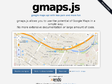
gmaps.js — Google Maps API with less pain and more fun
by 2 othersgmaps.js allows you to use the potential of Google Maps in a simple way.
No more extensive documentation or large amount of code.
2014
GMap Image Cutter
Includes a template to use the Image Cutter with Google Maps API v3 and fixes a bug with the maximum zoom level in version 1.41.
Create Zoomable Images Using The Google Maps API | Mike Gleason jr's Blog
by 1 otherAnyways, I'm pleased to show you two samples today: they both let you navigate into an image using the Google Maps engine. I'm also giving up the necessary tools to do it yourself. Enjoy!
2013
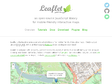
Leaflet - a JavaScript library for mobile-friendly maps
by 4 othersLeaflet is a modern open-source JavaScript library for mobile-friendly interactive maps. It is developed by Vladimir Agafonkin with a team of dedicated contributors. Weighing just about 33 KB of JS, it has all the features most developers ever need for online maps.
Proj4js by proj4js
by 1 otherJavaScript library to transform coordinates from one coordinate system to another, including datum transformations


MapTiler - Map Tile Cutter. Overlay Generator for Google Maps, Google Earth (KML SuperOverlay).
by 2 others (via)MapTiler is graphical application for online map publishing. Your map can create overlay of standard maps like Google Maps, Yahoo Maps, Microsoft VirtualEarth or OpenStreetMap and can be also visualized in 3D form by Google Earth. Only thing you have to do for publishing the map is to upload the automatically generated directory with tiles into your webserver.
Stately | The simple map font
Stately is a symbol font that makes it easy to create a map of the United States using only HTML and CSS. Each state can be styled independently with CSS for making simple visualizations. And since it's a font, it scales bigger and smaller while staying sharp as a tack.
2011

Isokron Maps « Isokron
Isokron Maps vous montre en quelques instants les zones les plus accessibles en métro par rapport à votre position.
Les applications possibles sont multiples : la localisation de mon nouvel appartement me permet-elle d'arriver au travail en moins de 20 minutes ? Quel point de rendez-vous peut arranger deux amis qui ne savent pas où se retrouver ?
2009

CloudMade Makes Maps Differently
by 4 othersCloudMade helps you make the most of map data. We source our maps from OpenStreetMap, the community mapping project which is making a free map of the world. Our aim is to continue the democratization of geo data and to expand access to open geo data through a range of simple yet powerful tools and APIs.
2008
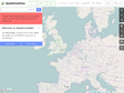
OpenStreetMap
by 21 othersOpenStreetMap is a free editable map of the whole world. It is made by people like you.
OpenStreetMap allows you to view, edit and use geographical data in a collaborative way from anywhere on Earth.
2007

香港地图,香港市地图,香港电子地图,香港三维地图,香港公交地图,香港交通地图_E都市
by 6 others, 1 commentHonk Kong en pixel art / google maps.
Blank map, Printable world map, Blank world map ALL FREE
by 12 othersThe all maps in this web site are licensed under a Creative Commons Attribution 3.0 License.
We are managing this web site by the advertisement income. All blank maps in this site are free of charge.
