public marks

PUBLIC MARKS from philippej with tags geographie & gps

2009

Calcul d'itinéraire (jogging, footing, course à pied, vélo...)

by 1 other

"... permet de calculer la distance totale, ainsi que le dénivelé, d'un parcours sportif effectué (jogging, footing, course à pied, vélo, roller...) en plaçant des points sur la carte."

2007

OpenStreetMap

by 2 others
« OpenStreetMap is a project aimed squarely at creating and providing free geographic data such as street maps to anyone who wants them. »

2006

Life of a Geolocated Blog Post

by 1 other (via)
« View entire photo sets as self-contained KMZ files in Google Maps »

GPSVisualizer Supports New Google Earth 4 Time Support

(via)
« ... use GPSVisualizer to make your own time stamped GPS track... »

2005

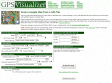
GPS Visualizer : Google Maps

by 3 others
GPS visualizer fait maintenant aussi de jolies cartes Google.

philippej's TAGS related to tag geographie

3d +   accessibilité +   agregateurs +   api +   application +   applications +   bookmarklet +   cartographie +   css +   data +   design +   earth +   economie +   email +   encyclopedie +   Environnement +   excel +   flash +   flickr +   foaf +   google +   gps +   GPX +   greasemonkey +   humour +   inclassable +   information +   javascript +   jeux +   kml +   livre +   maps +   microformats +   microsoft +   économie +   outils +   photo +   photos +   php +   pratique +   projets +   rss +   science_fiction +   screencasting +   semantique +   social +   société +   sport +   statistiques +   svg +   tags +   vin +   web +   weblogging +   weblogue +   wiki +   xml +   yahoo +