2009
Finally, Geoencoding in Lightroom! Announcing my GPS-Support Plugin
A plugin for Adobe Lightroom, “Jeffrey's GPS Support”, that adds support for Geoencoding photos from within Lightroom
Géolocalisation dans iPhoto '09
Il ne manque plus que l'ingestion d'un fichier de traces GPS pour localisation automatique et ce sera bien. La même chose dans Lightroom, ce serait top !
2008
GPSPhotoLinker: Overview
GPSPhotoLinker can be used to save location and GPS position data to a photo. The latitude and longitude recorded by your GPS unit while you were taking photos can be linked, and saved, to the photos. GPSPhotoLinker automatically enters the city, state...
myTracks
myTracks is a Mac OS X 10.5 application for the ambitious hobby photographer. The main idea of myTracks is the handling of GPS tracks and their relations to photos taken during the track
AMOD AGL3080: an in-depth review. | Blog-Shmog
I've recently had the opportunity to test-drive the AMOD AGL3080 GPS Logger. And... I'm impressed.
locr - locate your photos
With the free locr PC software, you are able to geotag photos automatically and simultaneously. All you need is a GPS-datalogger and the locr GPS Photo for Windows software.
GeoSetter for Windows
GeoSetter is a freeware tool for Windows for showing and changing geo data of image files (e.g. images taken by digital cameras).
GpsPasSion Forums - [TOPIC] iBlue 747 Bluetooth Logger with MTK
The iBlue 747 is a dual function GPS receiver with Bluetooth connectivity and 16Mb of onboard memory for data logging
G p s P a s S i o n
by 1 otherLe géocodage de photos consiste à ajouter une position GPS (latitude/longitude) à une photo pour mémoriser l'endroit exact où elle a été prise
2007
geobloggers » Flickr, KML, and a stroll down memory lane.
Flickr va très prochainement ajouter des liens vers des flux KML pour Google Earth en plus des liens RSS, mais c'est déjà utilisable, et ça déchire, comme on dit !
gpicsync - Google Code
by 2 othersGPicSync automatically inserts location in your photos metadata so they can also be used with any 'geocode aware' application like Picasa/Google Earth, Flickr, loc.alize.us, etc.
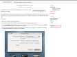
scriptaMac.at - Software
(via)The GeoTagging Automator Action automatically tags your images with geographical coordinates and elevation data from a GPS track file. It supports a great range of image formats, including many raw image formats like Canon CR2, Nikon NEF and Adobe DNG.
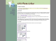
GPSPhotoLinker: Overview
by 4 othersGPSPhotoLinker can be used to save location and GPS position data to a photo. The latitude and longitude recorded by your GPS unit while you were taking photos can be linked, and saved, to the photos. GPSPhotoLinker automatically enters the city, state, and country annotations into the metadata.
home
The Jelbert GeoTagger is a compact device, smaller than most
flash guns, that uniquely connects to the camera flash shoe and follows the direction of the camera lens. When fitted, it will record the precise location AND direction of every outdoor photograph you take.

PhotoGPSEditor 1.0 - MacUpdate
PhotoGPSEditor is an easy to use meta-data editor for JPEG (photo) files, plus it can match data from GPS (gpx) files.
2006

Nokia's N95 smartphone goes legit - Engadget
(via)Nokia N95, including a 5 megapixel camera, integrated GPS, 802.11g WiFi, HSDPA, microSD, 150MB of internal memory and pretty much any other spec you could ever care to have stuffed into your phone
1
(16 marks)
