September 2008
CanadaInfo: Images & Downloads: Fact Sheets to Download: Maps
(via)Everyone in Canada and around the world should have access to material to help learn more about the Dominion of Canada. Below you will find thumbnails of a series of different pictures, maps, and information sheets that are free to download to your computer and use for educational purposes.
To download a .JPG file, click on the image you want so that it loads in a new page full size. Then, copy the image (click and hold for Macintosh, right click for Windows) and finally, paste the image into any word processing or drawing application.
To download a .PDF file, click on the link below the title of the image you want You must have Adobe Acrobat Reader to open this type of file. Click here to download Adobe Acrobat Reader.
June 2008
quikmaps.com :: maps for the masses
by 10 othersPersonalize a google map and then share. No registering required
November 2007
Outline Maps
by 1 other (via)These maps may be printed and copied for personal or classroom use.To request permission for other purposes please contact the Rights and Permissions Department.
PDF format but may be opened in Photoshop Elements as an image for coloring and labeling.
October 2007
Exploratree - Exploratree by FutureLab
by 6 othersExploratree is a free web resource where you can download, use and make your own interactive thinking guides. Thinking guides can support independent and group research projects with frameworks for thinking, planning and enquiry. We’ve provided a set of ready-made guides which you can print out or use online. All of the guides are completely customizable or you can start from scratch and make your own! You can share them and work on them in groups too.
With Exploratree you can:
Use our ready-made thinking guides
Make a new thinking guide from scratch
Use it to set class projects
Print them out (they can go as big as A0)
Change and customise thinking guides, you can add or change text, shapes, images etc.
As a teacher, you can set up the sequence that you want the thinking guide to be revealed, so that you can stage the thinking activity
You can fill in a thinking guide and complete your project on the website
You can present your project
You can send your thinking guide to a whole group of people
You can submit a thinking guide for comments, so it can't be edited but just reviewed
Work in groups on the same thinking guide
September 2007
Teacher Resources - Collection - Panoramic Maps, 1847-1929
(via)Ideas for using the Panoramic Maps collection from the Library of Congress Panorama Map Collection. Ideas for US History, Critical Thinking, and Arts & Humanities.
March 2007

Wayki: Show People Where!
by 4 othersQuick way for students to create map markers with photos and descriptions then share via a link. No signup required.
February 2007
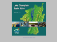
Lake Champlain Basin Atlas
The Lake Champlain Basin Atlas by the Lake Champlain Basin Program contains more than 40 full-color maps about the Lake Champlain Basin, articles about the maps, photographs, and a glossary. Extra resources, such as website links, manuals, and factsheets are also available. This 2004 version is loaded with lots of new information, many revised maps, and a new Students and Educators page!
January 2007
World66 - Your travel maps
by 1 otherMy World66 is a service where you can create a map of the places you have visited. Choose countries of the world, states, Candadian provinces, or European Countries. Generate the html to place in webpage or right click to copy or save image. Easy to use...no signup.
December 2006
November 2006
quikmaps.com - new
by 12 othersDraw pictures and label things on a google map using simple clicks and drags. Easily move the map to anywhere in the world.
Quikmaps is perfect for: drawing a map to the next soccer game, sketching out a the virtual spanish trip, or telling everyone where you saw the grizzly bear.
1
(10 marks)