2010
BIB - Zotero et Piggy Bank - YouVox Tech - Magazine participatif sur la convergence Internet, médias, télécom | Où vont les moteurs de recherche ?
on voit apparaître des outils infiniment plus intéressantes qui associent à la prise de notes, le stockage des pages que l’on visite sur le net (un peu à la manière de Digg, Kaboodle, Livelocker ou de cette extension très originale sur Firefox : Piggy bank…) et des outils de traitement de l’information spécifiques. J’en citerai trois : Sohonotes, qui réside sur l’ordinateur, et deux extensions de Firefox : Googlenotebook et, surtout, Zotero.
2007
Convertir vos traces GPS vers Google EarthLa France vue du ciel / Survol de France : Photos aériennes de France
Convertir vos traces (aux format standards IGC, NMEA, trk (PCX5) et les logs GPS Bluetooth der PDA RoyalTek Bluetek RBT3000) en trace Google Earth, avec moulinette .Donne points de départs et d'arrivée , Altitude et vitesse, Altitude et vitesse max.

Google Tag Cloud Maker__Extension_permet d'afficher à côté de vos résultats Google habituels un de ces fameux nuages de tags.
by 3 othersPermet d'afficher à côté de vos résultats Google habituels un de ces fameux nuages de tags. Celui-ci présente les mots les plus fréquents dans les résultats de votre recherche. Un clic sur l'un deux l'envoie dans la barre de recherche, permettant a
Hack Google Maps URLs to zoom way in - Lifehacker
Google expert Philipp Lenssen details how to manipulate Google Maps URLs to zoom in close enough to see an individual camel in the middle of Africa. The technique doesn't work in all locations, but here's how to give it a try: 1. Select a location and swi
2006
worldinpictures.org____Flickr geotagging application
by 1 otherallows you to view photos taken at any worldwide location. When you enter a location above, this is converted into a latitude/longitude pair which is used to look up "geotagged" photos on the photo sharing site Flickr. If you want your own pictures to app
BlockRocker > GeoTag Your Photos ____Flickr API Services (-)
GeoTag Your Photos You need to sign into Flickr and give BlockRocker.com permission to add Tags to your photos.
Flickr: loc.alize.us - All Our Flickr Photos on Google Maps! - GeoTagging Flickr (-)
loc.alize.us - All Our Flickr Photos on Google Maps! view profile aemkei Pro User [ FS FI INT ] says: After the great feedback on the Localize Bookmarklet I got the next secret something for you guys: A tool to browse the world of Flickr photos! Here you
loc.alize.us – Explore your world through everyone's eyes ___Bookmarklet Flickr extention
by 1 otherA smart way to browse and locate Flickr images on large map of the world. Filter photos by selecting a specific tag or searching for your buddy's user name. All navigation is done without any page refresh. An app that may save your boring afternoons. pro
Flyr Pool 0.3 - insert a google map_6V8 - Production of my Mind____Flickr
Here is a Greasemonkey script to insert a google map _ (generated by Flyr) directly on the Flickr pages with multiple photos that contains geotags.
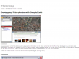
Geotagging Flickr photos with Google Earth
by 2 othersor those interested in geotagging via Google Earth I've writen a web app to do this.

MAKE: Blog: HOW TO GPS Tag Photos: Flickr, Mappr, Google Earth....
by 12 othersHOW TO GPS Tag Photos: Flickr, Mappr, Google Earth....
2005
Google Mapped Housing Listings ;Airtight News
This is a fantastically useful integration of Google maps and Craigslist housing listings. There are no API’s available for either service, so there must be a lot of screen scraping going on in the background. The whole thing is really well done - it’
Userscripts.org: Google Maps in Flickr
There's an easy way to see your geotagged photos on Gmap without leaving flickr. Just install the greasemonkey script to your firefox and see your photos shown on map right away. There will be a button added at the right-most of button bar if the photo is
GMiF - (Google Maps in Flickr)_+_del.icio.us Flickr Contacts_+_LfVr -(a Lightweight flickr )ViewerYuan.CC Web Experiments
by 7 othersThere's an easy way to see your geotagged photos on Gmap without leaving flickr. Just install the greasemonkey script to your firefox and see your photos shown on map right away. There will be a button added at the right-most of button bar if the photo is
Ted's Mozilla page - Google Maps Live
by 1 otherAllows you to feed latitude/longitude data to Google Maps and have it tracked in realtime
Geotagging Flickr with Google Maps and Greasemonkey Part 2
by 11 othersne fonctionne que pour USA et Irlande
1
(19 marks)
