2010


TuxMobil: Linux Applications for GPS Navigation & Geographic Maps
This is a survey of Linux applications (almost all of them are Free Software) for navigation with laptops, notebooks, handhelds, PDAs and mobile phones. They are useful for bikers, car drivers, ship and air plane navigators and others. Additionally there are map conversion tools and links to freely available maps for GPS devices.
GPSd — Put your GPS on the net!
gpsd is a service daemon that monitors one or more GPSes or AIS receivers attached to a host computer through serial or USB ports, making all data on the location/course/velocity of the sensors available to be queried on TCP port 2947 of the host computer. With gpsd, multiple location-aware client applications (such as navigational and wardriving software) can share access to receivers without contention or loss of data. Also, gpsd responds to queries with a format that is substantially easier to parse than the NMEA 0183 emitted by most GPSes. The gpsd distribution includes a linkable C service library, a C wrapper class, and a Python module that developers of gpsd-aware applications can use to encapsulate all communication with gpsd.
2009


2008
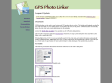
GPSPhotoLinker: Overview
GPSPhotoLinker can be used to save location and GPS position data to a photo. The latitude and longitude recorded by your GPS unit while you were taking photos can be linked, and saved, to the photos. GPSPhotoLinker automatically enters the city, state...
2007

TakItWithMe - TakItWithMe - GPX Uploader
Use this simple form to upload GPX files from your local computer to your Garmin GPS. This tool does not copy or send your GPS information to the internet.
Geotagger
Geotagger is a droplet for inserting GPS coordinates into your photos.
Simply position Google Earth (version 4 only) over the location you wish to insert into your images, then drag your images (jpegs only) onto the Geotagger icon. Once the images are tagged the information stays with them so you can import them to iPhoto, upload them to Flickr or Panoramio or any number of other things. If you choose iPhoto you may want to check out a plugin I wrote that will export your photos to a KMZ file that you can open in Google Earth and see your photos on the globe.

GPSPhotoLinker
GPSPhotoLinker can be used to save location and GPS position data to a photo. The latitude and longitude recorded by your GPS unit while you were taking photos can be linked, and saved, to the photos. GPSPhotoLinker automatically enters the city, state, and country annotations into the metadata.
GPSPhotoLinker: Overview
GPSPhotoLinker can be used to save location and GPS position data to a photo. The latitude and longitude recorded by your GPS unit while you were taking photos can be linked, and saved, to the photos. GPSPhotoLinker automatically enters the city, state, and country annotations into the metadata.
Ogle Earth: GPS and geotagging, now automated on the Mac
GPS Automator Actions by Austria's Sigurd Buchberger lets you use Mac OS X's built-in scripting tool to download data from connected GPS devices, convert that to KML and many other formats, and also upload to GPS devices.

PhotoGPSEditor 1.0 - MacUpdate
PhotoGPSEditor is an easy to use meta-data editor for JPEG (photo) files, plus it can match data from GPS (gpx) files.


