2015

2014
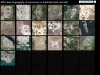
40 Maps That Explain The Middle East
Maps can be a powerful tool for understanding the world, particularly the Middle East, a place in many ways shaped by changing political borders and demographics. Here are 40 maps crucial for understanding the Middle East — its history, its present, and some of the most important stories in the region today.
2013

Vector Tiles for MapBox Streets | MapBox
by 1 otherMapBox has developed an open source vector format to power the future of our web maps.
Placing Literature
Placing Literature is an online database of places from scenes in literature- sourced and plotted by readers and researchers.


Ushahidi
The core platform is built on the premise that gathering crisis information from the general public provides new insights into events happening in near real-time.
Baidu Maps
Baidu Maps ou Beidu Maps est un service de cartographie en ligne chinois qui vise à concurrencer Google Maps en utilisant les futures images et relevés GPS du programme Beidou.
La cartographie de la Chine avait en 2011 un rendu visuel original, utilisant des dessins rappelant le jeu vidéo SimCity, à la place des images satellites classiques1

dis-moi où tu me plaîs
Carte interactive des amours métropolitains (sur la base des annonces de http://croisedanslemetro.com)

Development Seed
by 1 otherDevelopment Seed is a creative data visualization and mapping team based in Washington, DC. We help organizations use data to explain complex issues and make better decisions. We work on projects with partners in government, international development, and the private sector who are trying to make things better, improve policy, and touch the lives of people around the world.
WhatWasThere - Put history in its place!
by 1 otherThe WhatWasThere project was inspired by the realization that we could leverage technology and the connections it facilitates to provide a new human experience of time and space – a virtual time machine of sorts that allows users to navigate familiar streets as they appeared in the past.
TileMill | Fast and beautiful maps
by 3 othersMake beautiful interactive maps
Whether you're a journalist, web designer, researcher, or seasoned cartographer, TileMill is the design studio you need to create stunning interactive maps.
Create beautiful dynamic data driven maps | CartoDB
by 1 otherCartoDB is a cloud based mapping, analysis and visualization engine that lets users build spatial applications for both mobile and the web. CartoDB was launched in April 2012 and version 2.0 rolled out in November 2012.


Visualizing 50 years of The Rolling Stones
by 1 other50 Years of concerts of The Rolling Stones
An interactive map of their live-show story.
2012
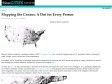
Mapping the Census: A Dot for Every Person - Design - The Atlantic Cities
Brandon Martin-Anderson, a graduate student at MIT's Changing Places lab, was tired of seeing maps of U.S. population density cluttered by roads, bridges, county borders and other impediments.
Fortunately for us, he has the technological expertise to transform block data from the 2010 Census into points on a map. One point per person, and nothing else.

Data journalism and mapping tools made easy | CartoDB
by 1 otherDeliver complex stories through engaging visualizations, allowing your readers to dive into the content that matters most. Get involved in a new breed of journalistic reporting and news applications, and deliver data driven maps with ease.

Google Maps API - More Than A Map
by 1 otherThe Google Maps API is more than a map for your apps. Explore demos of unique features that you can use in your apps today!

The World's Most Haunted Places
We're all fascinated by things that go bump in the night - so long as they're nowhere near us. Now, you can finally explore the ghoulish goings-on around the world - at arm's length, of course. Countless hauntings are said to take place in different locations on the globe. Below, you can discover where and why! embed

The one million tweet map #onemilliontweetmap
(via)A geographical clustering engine for online maps to display and analyse big geolocalized data.


UNIVERSERIES
The first website dedicated to US TV Shows through their creators.
See how they influence each other, who worked with whom and how,
and navigate through the map of creators from the 50’s to nowadays.
Tandems
Avec ARTE, élisez le jumelage emblème de l’amitié franco-allemande !
The Forgotten Mapmaker: Nokia Has Better Maps Than Apple and Maybe Even Google - Alexis C. Madrigal - The Atlantic
It's impossible to create a perfect map, but that hasn't stopped Nokia from trying. Here, we go inside the company's neverending drive to create a digital copy of the world.
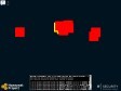
HoneyMap
You are looking at the HoneyMap, a real-time world map which visualizes attacks captured by honeypots of the Honeynet Project. Red markers on the map represent attackers, yellow markers are targets (honeypot sensors).