2011

CodesScripts.fr | Latitude et longitude avec Google Maps
Cette page utilise l'API Google Maps pour déterminer des coordonnées géographiques (latitude et longitude).
Les coordonnées sont données en degrés décimaux, comptés positivement vers le Nord pour la latitude, et vers l'Est pour la longitude. Les valeurs calculées par l'API Google Maps ayant une précision illusoire, elles sont arrondies à 7 chiffres après la virgule, ce qui correspond à une précision de l'ordre du centimètre, largement suffisante pour les utilisations courantes!
Google Maps API Example: Simple Geocoding
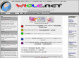
Coordonnées GPS d'apres une adresse et plan Maps Goggle
2010
TuxMobil: Linux Applications for GPS Navigation & Geographic Maps
This is a survey of Linux applications (almost all of them are Free Software) for navigation with laptops, notebooks, handhelds, PDAs and mobile phones. They are useful for bikers, car drivers, ship and air plane navigators and others. Additionally there are map conversion tools and links to freely available maps for GPS devices.
Ride with GPS
"... a recreational route sharing community for cyclists, motorcyclists, runners, hikers, mountain bikers, and anyone else who is involved in a route-oriented sport."
Un des nombreux outils en ligne permettant de tracer un parcours d'après une carte Google Maps. Petit + : l'élévation des tracés à l'air assez précise.
2009

Coordonnées GPS - Géolocalisation - Torop.Net
Entrez une adresse ou validez celle indiquée par défaut.
Puis déplacez le marqueur comme bon vous semble.

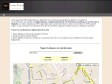
Coordonnées GPS d'apres une Adresse
Entrez une adresse ou validez celle indiquée par défaut. Puis déplacez le marqueur comme bon vous semble.
La position GPS de la Chapelle est indiquée
Calcul d'itinéraire (jogging, footing, course à pied, vélo...)
"... permet de calculer la distance totale, ainsi que le dénivelé, d'un parcours sportif effectué (jogging, footing, course à pied, vélo, roller...) en plaçant des points sur la carte."
2008
Skyhook Wireless
Si vous trouvez qu'il est difficile de trouver où vous êtes avec la recherche automatique proposée par votre iPhone ou iPod Touch, vous pouvez maintenant référencer de nouveaux hotspots WiFi, à commencer par le(s) votre(s) !
2007
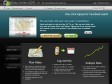
Dash Express Automotive Navigation System
Superior traffic with the Dash Driver Network™:Select your route based on up-to-the-minute traffic data that is automatically and anonymously exchanged via the most reliable source–other Dash devices.
dismoiou.fr
Participez à une oeuvre collective et vivante : la description du monde
Mettez en valeur les lieux que vous aimez en les conseillant à d'autres internautes
Réutilisez librement l'information créée dans votre blog, site web, GPS ou mobile
GPS Visualizer
GPS Visualizer is a free, easy-to-use online utility that creates maps and profiles from GPS data (tracks and waypoints), street addresses, or simple coordinates.
gpicsync - Google Code
GPicSync automatically inserts location in your photos metadata so they can also be used with any 'geocode aware' application like Picasa/Google Earth, Flickr, loc.alize.us, etc.
Search free Garmin maps by location
Click any location on map to find downloadable maps for Garmin and compatible navigators. Then click 'show on map' link in search results to see the area covered by the found map.
MapMyRun.com -- Mapping your running routes has never been easier!
Find your Address in the "BEGIN HERE" box on the left, then click on the map below to plot your Walk. This site is great for your fitness, training, and wellness needs! You can Drag & Drop and Edit your points on your walk route. To Edit, click on the ico
GPS Visualizer: Google Maps input form
This form will automatically draw your GPS data (or KML/KMZ file, or plain text data in CSV or tab-delimited format) overlaid upon street maps and satellite imagery in Google Maps.
OpenStreetMap
« OpenStreetMap is a project aimed squarely at creating and providing free geographic data such as street maps to anyone who wants them. »
2006

Life of a Geolocated Blog Post
« View entire photo sets as self-contained KMZ files in Google Maps »


Hotel World Map
If you're looking for a hotel close to the beach, or near some tourist atttraction in a city, or just or a cheap place near the airport, you need to try this. This lets you find 60.000 accomodations worldwide on an interactive Google Map. Intuitive map-based search engine, with a few nice web 2.0 features.