2010
gps4cam | An app4cam product.
outil bureau + iphone pour géolocaliser les images
1er Twunch Metz « La Moselle sur le web
RT @Passyr: #TWM 1er #twunch #Metz infos ici http://bit.ly/11VjvP -- inscriptions ici http://bit.ly/7FGZS (19 participants) RT PLZ [from http://twitter.com/kemar/statuses/3540251934]
2009
Géolocalisation dans iPhoto '09
Il ne manque plus que l'ingestion d'un fichier de traces GPS pour localisation automatique et ce sera bien. La même chose dans Lightroom, ce serait top !
2008
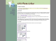
GPSPhotoLinker: Overview
GPSPhotoLinker can be used to save location and GPS position data to a photo. The latitude and longitude recorded by your GPS unit while you were taking photos can be linked, and saved, to the photos. GPSPhotoLinker automatically enters the city, state...
Fish-Track » KMLToGPX Converter 2.0 Released
Convert kml files to gpx on your desktop with the KMLTOGPX converter software.
GPS-Info CMM - Display and use GPS coordinates embedded in photos directly in the Finder
GPS-Info CMM is a Contextual Menu Module designed for Mac OS X that displays the GPS coordinates of a photo file, and allows you to view that location in Google Earth, Flickr, Panoramio, Google Maps, or MapQuest.
Apple - Downloads - Math
A utility for uploading, downloading, and transcoding GPS data among GPS devices, GPX files, and KML files (for Google Earth). The resulting files can be used in a variety of applications available for the Macintosh, including TrackRunner, TrailRunner, and of course Google Earth.


2007
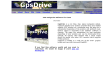
GpsDrive
GpsDrive is a car (bike, ship, plane) navigation system. GpsDrive displays your position provided from your NMEA capable GPS receiver on a zoomable map, the map file is autoselected depending of the position and prefered scale. Speech output is supported if the "festival" software is running. The maps are autoselected for best resolution depending of your position and can be downloaded from Internet. All Garmin GPS reveiver with a serial output should be usable, also other GPS receiver which supports NMEA protocol.
GpsDrive is written in C with use of the GTK graphic toolkit and runs with Linux and FreeBSD.
GPSNavX
Marine Navigation & Charting Application for OS X
GPSNavX™ is the very affordable solution for the boater that wants to take the Mac aboard for real-time display of position on full color marine raster format BSB and Softcharts.
Plug your GPS into your Mac and watch as your boat moves along in real-time, plotting a track behind the boat and logging your historic position on a digital chart
HoudahGeo - Geocoding for the Mac
HoudahGeo may operate in a fully automatic mode when provided a track log file from a GPS receiver. Finer control is possible by attaching photos to waypoints created using a GPS device.
LoadMyTracks
GPS Connectivity for your Macintosh
LoadMyTracks is a piece of software that will communicate with GPS devices from many manufacturers to send and receive data. It can also be used to translate data between the popular GPX and KML (Google Earth) formats.
The software provides support for Waypoints (single locations in space), Routes (lists of waypoints that can be used as instructions of where to go, Tracks (the breadcrumbs that many GPS devices keep to show where you have been) and additional data that may vary by device.
PhotoGPSEditor
PhotoGPSEditor is an easy to use meta-data editor for photo files, plus it can match data from GPS (gpx or NMEA) files. The program is freeware, however, donations can be made to help support future development.