2009
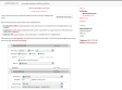
Calcul d'itinéraire (jogging, footing, course à pied, vélo...)
"... permet de calculer la distance totale, ainsi que le dénivelé, d'un parcours sportif effectué (jogging, footing, course à pied, vélo, roller...) en plaçant des points sur la carte."
2008
Apple - Downloads - Math
A utility for uploading, downloading, and transcoding GPS data among GPS devices, GPX files, and KML files (for Google Earth). The resulting files can be used in a variety of applications available for the Macintosh, including TrackRunner, TrailRunner, and of course Google Earth.
2007
GPS Visualizer
Pour tous les geeks qui font joujou avec leur récepteur gps. Indispensable. GpsVisualizer formate tout type de fichier de données gps (.trk, .gpx, ...) pour Google Earth, Google Map, en image .jpg, .png,...
geobloggers » Flickr, KML, and a stroll down memory lane.
Flickr va très prochainement ajouter des liens vers des flux KML pour Google Earth en plus des liens RSS, mais c'est déjà utilisable, et ça déchire, comme on dit !
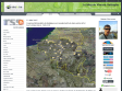
Tous les McDonald’s de Belgique sur Google Earth et dans votre GPS !
Hors de ma vue mécréant ! Vinch a osé passé tout son samedi à encoder les données gps des 57 McDo de Belgique. Si c'est pas honteux ! Moi qui fait régime... bon, vais quand même télécharger tout ça, on ne sait jamais. :)
TrailRunner
TrailRunner is a route planning software for all kinds of long distance sports like running, biking, hiking, inline-skating, skiing and more. If you ever asked yourself how long your workout routes are and what route you should choose for this evening — then TrailRunner should be your training-partner.
scriptaMac.at - GPS Automator Actions
A set of Automator Actions to download, upload and convert GPS routes, waypoints and tracks.
LoadMyTracks
LoadMyTracks is a piece of software that will communicate with GPS devices from many manufacturers to send and receive data. It can also be used to translate data between the popular GPX and KML (Google Earth) formats. The software provides support for Waypoints (single locations in space), Routes (lists of waypoints that can be used as instructions of where to go, Tracks (the breadcrumbs that many GPS devices keep to show where you have been) and additional data that may vary by device.
Ogle Earth: GPS and geotagging, now automated on the Mac
GPS Automator Actions by Austria's Sigurd Buchberger lets you use Mac OS X's built-in scripting tool to download data from connected GPS devices, convert that to KML and many other formats, and also upload to GPS devices.
2005
1
(11 marks)
